Ingest
Bring satellite tiles, drone imagery, elevation products, historical maps, GPX traces, and GIS layers into one analysis pipeline.

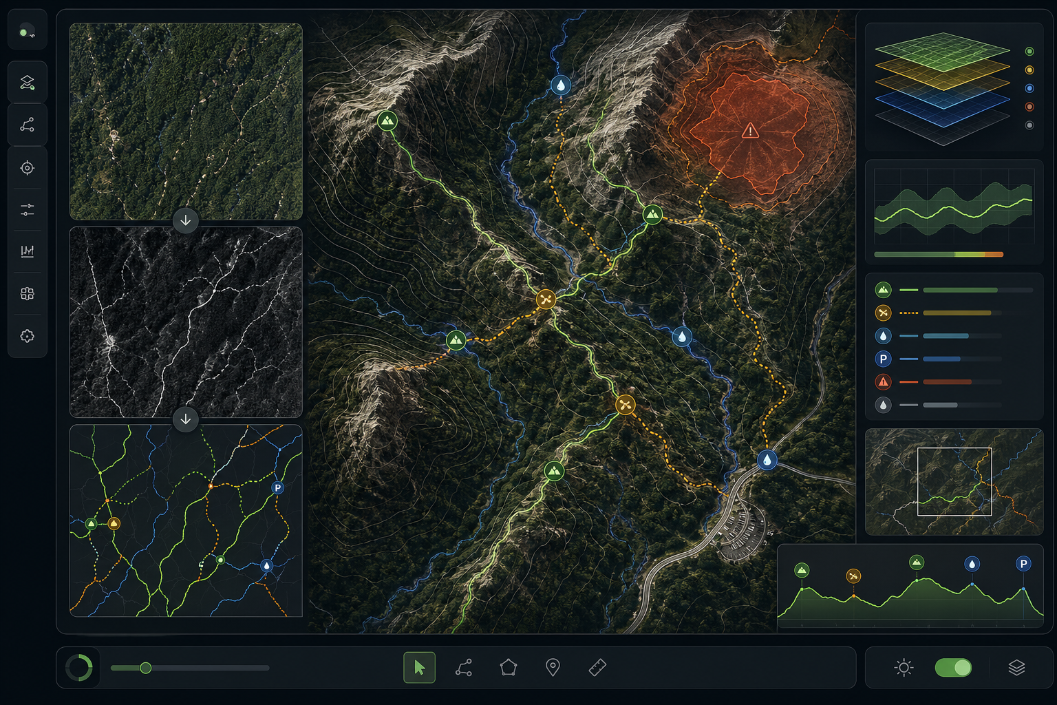
Temple Intelligence presents AtlasTrail AI
AtlasTrail AI analyzes satellite imagery, aerial data, topography, and existing map layers to find trails, trailheads, route connections, water crossings, scenic viewpoints, access points, and field-relevant places.
Capabilities
AtlasTrail AI combines computer vision, terrain reasoning, and human review loops to identify map features that matter when people need to move through real terrain. The system is built for parks, land managers, outdoor navigation companies, emergency planners, conservation teams, and organizations maintaining large trail inventories.
Product
Bring satellite tiles, drone imagery, elevation products, historical maps, GPX traces, and GIS layers into one analysis pipeline.
Run trail detection, route connectivity checks, POI classification, terrain segmentation, and anomaly discovery models.
Review model suggestions with confidence scoring, evidence snapshots, audit history, and field-verification status.
Export clean vectors, metadata, and change reports for GIS, web maps, navigation apps, and operational planning.
Purchase Information
The recommended entry point is a 30-day pilot for one defined region. Temple Intelligence configures the model workflow, processes your source data, delivers candidate trail and POI layers, and reviews the results with your mapping or operations team.
AtlasTrail AI Pilot
$4,800 starting price
Enterprise licensing, API access, and custom model training are available after pilot validation.
About Temple Intelligence
Temple Intelligence develops machine-learning products that help organizations interpret complex geospatial data. Our work focuses on practical outputs: route networks that can be reviewed, points of interest that can be verified, and map intelligence that supports decisions in the field.
Contact Us
Contact Temple Intelligence for pilots, procurement questions, technical scoping, or partnership discussions.